1936 map of Taipei
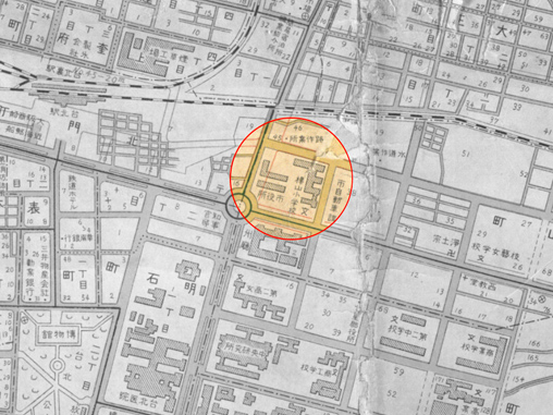
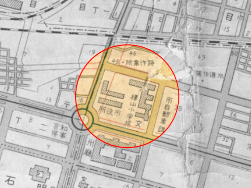
Image no.
1-1
Source
National Taiwan Library
Description
This is a 1936 street map of where the Executive Yuan now stands. The site was then occupied by Huashan Elementary School and later by the Taipei Municipal Office. Following Taiwan’s restoration to ROC rule, it became the premises for the Office of the Taiwan Provincial Administration and the Taiwan Provincial Government.